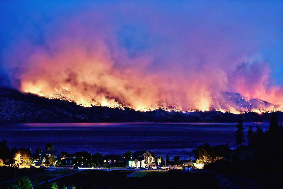
Update fire

The experts said that fires generally burn up and across, but not down. The fire started at 5000' and most of it lies above 6000'. There are many peaks of 7000+' with high ridges between them. At the lower left you can see were the fire started. There is about 5 sq-km burnt around a branch of Kutekl creek. Note the red areas are burning. This may continue to burn west, but will stop at Ymir Mtn because it's a rocky ridge. Whitewater is on the other side of the Mtn. From there it burnt east along the north side of Kutekl creek, stopping short of the junction of Midge creek. There is a logging road at that point, and I think they stopped the fire there because of the park boundry. From there is burnt north up a branch of Kutekl creek and splitting around Mt Lasca. It passed to the east of the mountain into the head of the west branch of Harrop creek. The fire expert said it would take weeks to travel down the creek to Harrop, and they would not attempt to put it out because the terrain is too dangerous. I've hiked up both Lasca and Harrop creeks and did not find them very different. The fire also passed to the west of Mt Lasca entering the east branch of Lasca creek. The word 'Creek' on the map is were the camp sites and old growth is at the end of the trail. To the east is an active fire. Forest Service said they have plans to bring heavy equipment up the logging road and build a fireblock. However, they don't want to do this because it is expensive, scars the park, and the fire may just pass around it. Or the fire may stop burning down the valley.
Going back to were the fire started, you also see it head north over a ridge into the west branch of Lasca creek. This is mostly out.
To the west it passed into Five Mile creek were it is still burning. Forest service cleared an old logging road into the area and plans to build a fireblock.
Where else can the fire spread to? To the south-east of Mt Lasca is Mt Irvine (just above the top right corner of the map). You see it just north of Procter. The fire in Harrop creek could head SE along the high ridges. On the way it might drop into Narrows creek (just east of Harrop creek). This is unlikely because it is also steep.
If it reaches Mt Irvine it could spread to several high peaks in the area. More dangerous is that it could go down Procter creek. Forest Service said they would build fireblocks above Procter if this happens.
Forest Service says this is difficult fire to fight because there is no road access to high country. Fire fighters rapel down and build a helipad. However there are only four active fires, and today's rain probably put out the ground fires (the orange bits on the map).
In summary the fire poses no great risk to people or property as long as it stays high. There are only a few places were it could head down into the West Arm, and that could only happen quickly if winds blow north. That is very unlikely this time of year. Another possibility they mentioned was no heavy rains in the next months and the fire spreads slowly. This would be controlled by fireblocks above the communities.

Eén beeld zegt meer dan duizend woorden...
Misschien leuk!?


